ReLive: your movie from track and route
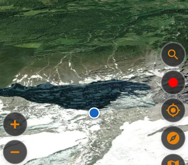
ReLive turns every track and route into a little movie — inspired by the well-known “Relive” app: the camera flies along the course in a tilted 3D view above satellite imagery while the line builds up in TDM orange. It opens with an overview showing name and distance and closes with the TD logo. You start it via “Animate track” on the track detail page or “Animate route” in the route editor; ReLive is a Pro feature.
There are two paths: the live animation plays the flight right in the app. “Create video” renders a real MP4 from it — frame by frame using your platform's hardware encoder, without an audio track. On Windows it lands in Videos\TDM, on Android additionally in the gallery, on iPhone and Mac in the app folder — after rendering you can open or share it right away.
For a smooth flight, TDM preloads the satellite and elevation tiles along the course before starting (with a progress bar) — after that the animation works even without reception. Small note: the start, finish and via pins are visible in the live animation but not yet in the exported video.
See also: The animation settings in detail · Track or route? The small but big difference · 3D flight: Eiger, Mönch & Jungfrau
The animation settings in detail
Before starting, the settings page opens — every change is remembered for next time:
- Orientation — landscape (video 1280×720) or portrait (720×1280), e.g. for social-media stories.
- Map orientation — “Perspective”: the camera turns into the direction of travel; “North up”: flat top-down view, tilt and follow mode are then locked.
- Duration (1–10 min, default 3) — length of the live animation; the whole course is flown in exactly this time.
- Video length (10–180 s, default 60) — length of the MP4, independent of the live duration; it is distributed over intro, fly-in, flight, fly-out and outro.
- Frame rate (15–60 fps, default 30) — more frames per second = smoother, but longer rendering and a bigger file.
- Camera height (1000–11000 m, default 6000) — the constant flying altitude above the course.
- Tilt angle (0–75°, default 62) — how obliquely the camera looks at the terrain; capped at 55° with 3D terrain.
- Camera inertia (1–100, default 50) — smooths the pans: low = direct, high = soft like a camera crane.
- Follow mode — camera behind, ahead, left or right of the ride; “Auto” changes the perspective over the flight.
- Map view — satellite (default), hybrid, road, terrain, TopPlus, hillshade or HERE Topo Day.
- 3D terrain — real elevation relief under the camera; only for very fast hardware.
See also: ReLive: your movie from track and route · Elevation model, hillshading and 3D